1 / 3
DroneNaksha drone photogrammetry (cloud)
Model DroneNaksha
Cloud photogrammetry from AeroMegh that turns drone images into orthomosaics, DSM, DEM and NDVI/VARI maps; plans from Rs 3,875/month.
 Sold byAeroMegh Intelligence Nashik
- Deployment
- DroneNaksha is cloud enabled ... It is cloud powered with full scale parallel processing
- Platforms
- Try Now / Buy Now -> services.aeromegh.com/signup (web app)
- Pricing model
- Pro Rs 3875/month or Rs 39343/year; Business Rs 7386/month or Rs 72566/year; Enterprise Rs 34286/month or Rs 329143/year; Image Processing Credits Rs 350 for 1 GB
Price
₹3,875
- Free
- No account
- Vendor replies
About this software
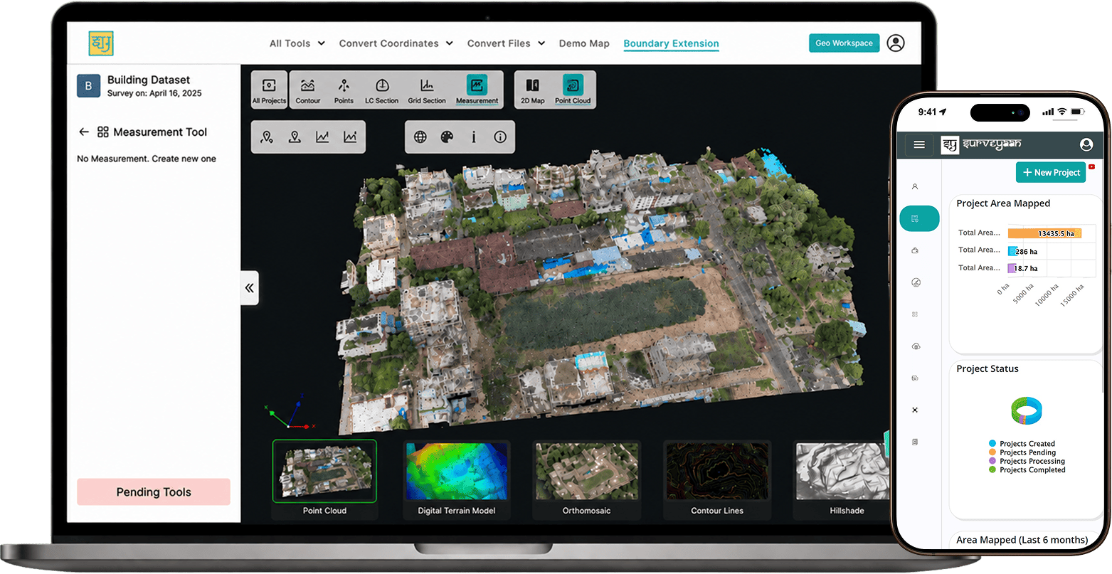
DroneNaksha is PDRL's cloud photogrammetry service on the AeroMegh platform. Users upload drone images from a computer or straight from the AeroGCS mission planning app, add ground control points and start processing; the service notifies them when outputs are ready. It produces orthomosaics, digital surface and elevation models (DSM downloadable as GeoTIFF) and vegetation index maps (NDVI from infrared, VARI from RGB images), and offers date-to-date comparison, volume measurement, 2D/3D views, CAD/shapefile/GeoJSON overlays and export of flight plans drawn on the orthomosaic. Pro, Business and Enterprise plans differ in storage (500 GB to 5,000 GB) and team size, and processing is bought as per-GB credits.
Specifications
5 of 5 published by the vendor. “Ask the vendor” means the brochure does not say.
Product
- Deployment
- DroneNaksha is cloud enabled ... It is cloud powered with full scale parallel processing
- Platforms
- Try Now / Buy Now -> services.aeromegh.com/signup (web app)
- Pricing model
- Pro Rs 3875/month or Rs 39343/year; Business Rs 7386/month or Rs 72566/year; Enterprise Rs 34286/month or Rs 329143/year; Image Processing Credits Rs 350 for 1 GB
- Supported drones / autopilots
- upload images from your computer device. User can also directly upload from AeroGCS mission planning software
- Output formats
- Along with orthomosaic, DroneNaksha also generates ... Digital Surface Model, Digital Elevation Model, Vegetation ... allows to download DSM in geo-tiff file format ... Visualization with CAD/Shape/GEO-JSON Overlay
AeroMegh Intelligence
Nashik
GeoAI platform for drone data analytics, photogrammetry, GIS insights, and aerial AI.
More details
- Made in
- India
DroneNaksha drone photogrammetry (cloud)
₹3,875