 1 / 2
Surveyaan GeoWorkspace Cloud Photogrammetry
Browser-based cloud photogrammetry that turns geotagged drone photos into orthomosaics, DSM/DTM, point clouds, 3D models and AutoCAD contours.
 Sold bySurveyaan Bengaluru
- Deployment
- Cloud Based Photogrammetry Software ... No Specific Machine Required
- Platforms
- Open Real Survey Environments Inside Our Browser-Based 3D Platform
- Pricing model
- Pay on use or subscriptions
Price
Price on request
Ask for a quote for your quantity and delivery location.
- Free
- No account
- Vendor replies
About this software
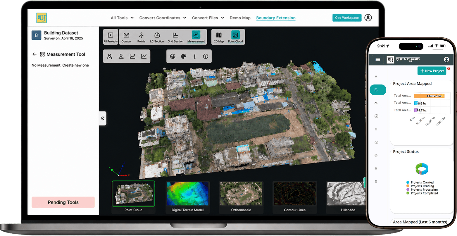
GeoWorkspace is Surveyaan's cloud photogrammetry service. Users upload geotagged RGB drone images and ground control point files from any device, the images are processed on Surveyaan's servers, and the results come back as orthomosaic maps, digital surface and terrain models, dense point clouds and textured 3D models. Tools in the browser cover elevation profiles and cross-sections, cut-and-fill and stockpile volumes, and point-cloud viewing and measurement. Exports include GeoTIFF, LAS/LAZ, OBJ and AutoCAD-ready DXF/DWG contours that open in ArcGIS, QGIS and Civil 3D. Billing is pay-per-use or by subscription, and there is a free trial with no credit card. No local workstation is needed. Documentation is online.
Specifications
6 of 6 published by the vendor. “Ask the vendor” means the brochure does not say.
Product
- Deployment
- Cloud Based Photogrammetry Software ... No Specific Machine Required
- Platforms
- Open Real Survey Environments Inside Our Browser-Based 3D Platform
- Pricing model
- Pay on use or subscriptions
- Free trial available
- Start With A Free Trial. No Credit Card Required.
- Supported drones / autopilots
- transforms geo-tagged RGB drone images ... Upload your drone-captured GCP files and images
- Output formats
- Export ... GeoTIFF, LAS, OBJ, DXF/DWG, and more; export in LAS/LAZ format; AutoCAD-compatible DXF and DWG formats - including contour maps, cross-sections, and LC profiles
Surveyaan
Bengaluru
Surveyaan (Indian drone manufacturing company), by Nibrus Technologies Pvt Ltd, manufactures affordable typecertified d…
More details
- Made in
- India
Surveyaan GeoWorkspace Cloud Photogrammetry
Price on request